Super bloom - South Bay Wildflower Chasers 2019
- Saved By Nature

- Mar 3, 2019
- 6 min read
Updated: Mar 4, 2019
Let’s cut to the chase and get right to it. So, you want to see some wildflowers huh?
Well, you came to the right place. I teamed up with my buddy Docent Ron Horii from Santa Clara County Parks and Santa Clara Valley Open Space Authority.
We picked our favorite hot spots in the South Bay using our years of experience of being out on the field.
We’re going to highlight four nature destinations that are great for wildflowers this time of year: Santa Teresa County Park, Rancho San Vicente/Calero County Park, Coyote Lake/Harvey Bear Ranch County Park, and Coyote Ridge Open Space Preserve.
Santa Clara County Parks Wildflower Trails
Many of the Santa Clara County Parks have beautiful wildflower displays in the spring.
Stile Ranch-Mine-Fortini Trail Loop, Santa Teresa County Park, 2.4 miles
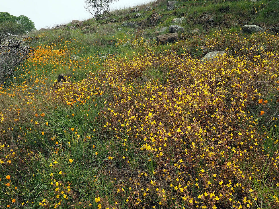
Santa Teresa Park has several great wildflower trails. One of the most spectacular is the Stile Ranch Trail. It begins in the Almaden Valley on San Vicente Avenue. Switchbacks cut into nearly solid serpentine rock climb up the steep hillside. Those switchbacks are lined with poppies, chia, and black sage. The poppies are so dense, they turn the hillside a bright orange. Seep spring monkeyflowers, serpentine sunflowers, and Mt. Hamilton thistles grow along a seep on the slope. Hillsides on the first valley are covered with serpentine linanthus, shooting stars, and California buttercups. A second set of serpentine switchbacks climbs through patches of California gilia. As the trail descends into a second valley, it passes by scattered royal larkspur, creamsacs, and lupines. Later in the season, most beautiful jewelflowers, common yarrow, golden yarrow, wiry snapdragon, and wavyleaf soaproot will be found all along the trail. The Stile Ranch Trail ends at the Mine Trail, which takes a steep but short climb over a hill, lined with poppies and phacelia, then meets the start of the Fortini Trail. The Fortini Trail is relatively flat, descending gradually into the Almaden Valley to rejoin the start of the Stile Ranch Trail. Along the way are endangered Santa Clara Valley dudleya, ithuriel’s spears, goldfields, tidy-tips, bee plants, black sage, and late in the season, mariposa lilies.


Lisa Killough Trail to Lisa’s Lookout, Rancho San Vicente/Calero County Park, 5.4 miles out-and-back
The 966-acre Rancho San Vicente is the latest addition to 4,471-acre Calero County Park. It contains 506 acres of serpentine soil, which supports a wide range of wildflowers. The easiest way to see the wildflowers is to take the Lisa Killough Trail to Lisa’s Lookout. It can be taken as part of a larger 8.7-mile loop that includes the Cottle Trail. The trail wraps around a serpentine-covered hill. A wide variety of native wildflowers thrive on the hill. There are poppies, cream cups, Douglas’ silverpuffs, popcorn flowers, owl’s clover, bird’s eye gilia, California gilia, muilla, and endangered Santa Clara Valley dudleya. Farther along the trail, the hillsides become carpeted with bright yellow goldfields. The trail runs through a manzanita forest, lined with monolopia, which look like tall goldfields. There is a viewing bench overlooking New Almaden and the hills of Almaden Quicksilver County Park. The trail wraps around a wide grassy valley, covered with goldfields. After passing through woodlands, it goes by hillsides with patches of linanthus and seep spring monkeyflowers. It crosses a creek on a bridge. The rare Mt. Hamilton thistle grows in little feeder creeks. The trail runs through a shady forest of California bay trees, with miner’s lettuce covering the understory. It eventually reaches Lisa’s Lookout, which has picnic tables and views of Calero County Park and Rancho Canada del Oro Open Space Preserve. This is the turn-around point, but the Lisa Killough Trail continues for 2.2 miles to reach the Cottle Trail. The Cottle Trail runs along the shore of Calero Reservoir and above McKean Road for 2.8 miles to meet the Lisa Killough Trail near its start.


Calaveras-Coyote Ridge-Harvey Bear Trail Loop, Coyote Lake/Harvey Bear Ranch County Park, 6.2 miles
Coyote Lake/Harvey Bear Ranch County Park is huge, covering 6,695 acres, including 449-acre Coyote Lake. While the park is popular for camping and boating, it has 35 miles of trails for hiking, biking, and horseback riding. Though wildflowers can be found throughout the park, the serpentine area midway along the Calaveras Trail is a wildflower hotspot. While this can be taken as an out-and-back from either end of the Calaveras Trail, it can be combined with the Coyote Ridge and Harvey Bear Trail to make a loop, with great views on both sides of the ridge. The start of the Calaveras Trail can be reached off the Harvey Bear Trail above the Coyote Lake Dam, with shooting stars and California buttercups along the way. The Calaveras Trail runs along the hillside, with views of Coyote Lake, passing fields of scattered buttercups, lupines, poppies, johnny-jump-ups, blue-eyed grass, fiddlenecks and baby stars. Once it reaches the serpentine area, the hills are densely-carpeted with goldfields, poppies, butter-and-eggs, tidy-tips, cream cups, jeweled onions, red maids, and dwarf plantain. The latter supports the threatened Bay checkerspot butterfly. This is one of the few places in the world where this butterfly still survives. If you continue to the Coyote Ridge Trail, it takes you along top of the ridge line, with views of Coyote Lake to the east and Gilroy/Morgan Hill to the west. The trail is lined with lupines, fiddlenecks, and poppies. It reaches the Harvey Bear Trail, which returns to the dam. On the way, the hiking-only Ed Wilson Trail can be taken as a side trip to reach the highest and northernmost part of the park. It has California milkweed and rare big-scale balsamroot.


Coyote Ridge Open Space Preserve, Docent led strenuous, 7.5-mile round-trip hike or Self-Guided Access Days: Easy-Access: Lower Area 2.5-miles of trail by registration only
This is the first year that SCVOSA is letting people do what they are calling “Self-Guided Access Days: Coyote Ridge.” This is a fantastic opportunity to explore this preserve on your own, there has only been Docent or Seasonal Educational Aide led hikes in the past.
If you want the grand tour they're having “Coyote Ridge Docent-Led Wildflower Hikes” too. This is where you have a guide tell you the backstory of the preserve, about the Bay checkerspot butterfly and all the names of the flowers. Either way this preserve is the place to be. Keep an eye out for tule elk, burrowing owl, and coyote. Enjoy being serenaded the entire time by the song from western meadowlarks.
Coyote Ridge Open Space Preserve is 1,859 acres located in the Diablo Range foothills.
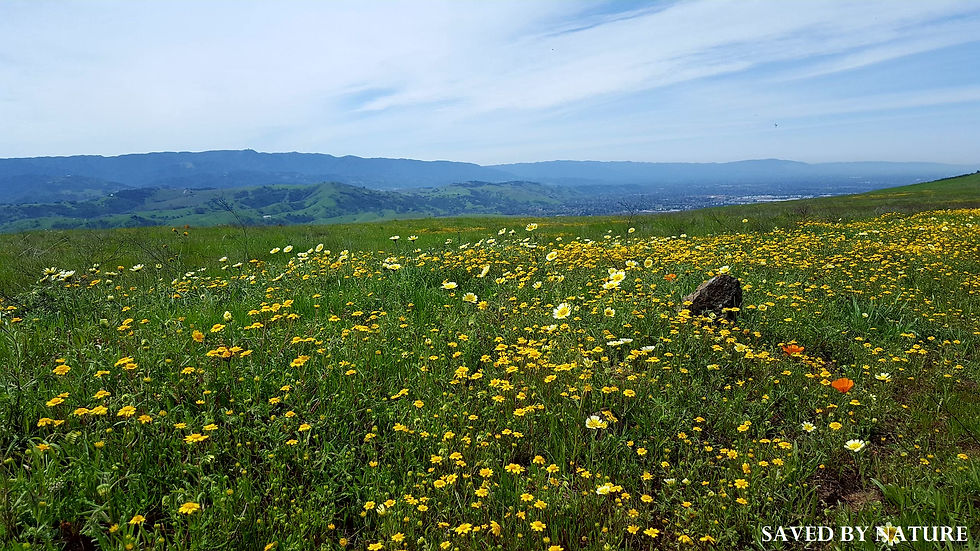
It’s a hidden gem overlooking Coyote Valley and the San Felipe Ranch, a personal retreat for Silicon Valley pioneers Bill Hewlett and David Packard purchased in 1954 as a place they could escape the pressures of Silicon Valley to hunt wildlife deer, elk, and mountain lions. The 28,539-acre ranch is about the same size as the city of San Francisco and through a donation now belongs to the Nature Conservancy. From the top of Coyote Ridge, if you look left, you can see Santa Clara County’s highest peak Copernicus Peak 4,360’.
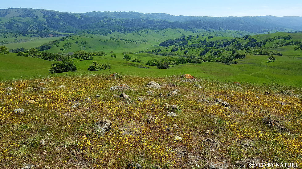
You can see wildflowers throughout the property, look for seeps where you'll find seep spring monkeyflower and the endemic Mt. Hamilton thistle. On the hike in, you may not see the red maids, but as the day warms up, they will open like the California poppies and you will notice them on your hike out. The rare fragrant fritillary can be found here for about three short weeks.

Look out for the "Yellow Brick Road" while you explore this fabulous preserve!
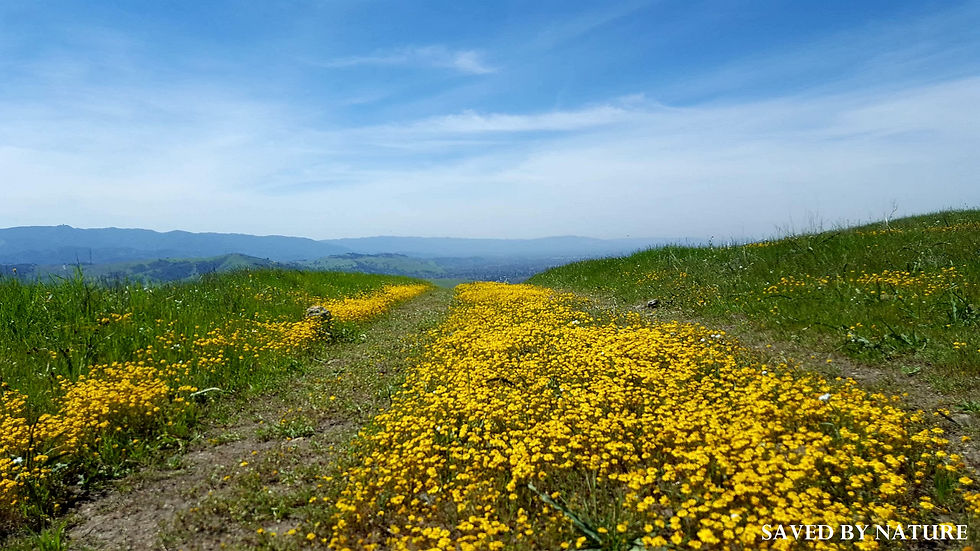
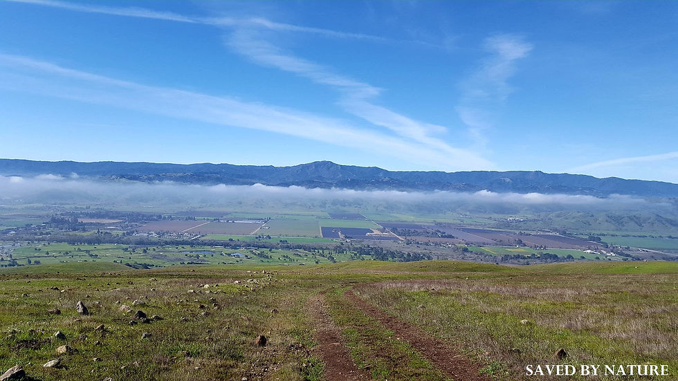
Stop and enjoy the view to the west that overlooks Coyote Valley (The Valley of Hope). Looking directly across you can see the Santa Cruz mountains highest peak Loma Prieta (3,790’), Mt. Umunhum (3,488′), and the Santa Teresa Foothills.
Native flowers here have evolved with the serpentine soil which is derived from our state rock serpentinite. It lacks nitrogen, phosphorous, and potassium (N-P-K ) but the wildflowers are able to thrive.

Here you can determine the underlying serpentine soil by the overlay of flowers.

Hope you enjoyed this article! Subscribe to our webpage, or follow us on Facebook and Instagram to stay informed of upcoming wildflower hikes.
It's 2019 - The Year of Environmental Inspiration! Get out and get you some Nature!
References:
Common Wildflowers in Santa Clara County Parks: https://www.sccgov.org/sites/parks/Whats-Happening/Documents/WildflowerHikes.pdf
Wildflower Treasure Hunt (Santa Clara County Parks): https://www.sccgov.org/sites/parks/Whats-Happening/Documents/sccp-wldlfr17-web.pdf
Wildflowers of the Serpentine Realm: https://www.sccgov.org/sites/parks/parkfinder/Documents/Wildflowers-of-the-Serpentine-Realm.pdf
Coyote Ridge Open Space Preserve – Santa Clara Valley Open Space Authority website: https://www.openspaceauthority.org/visitors/preserves/coyoteridge.html
Richard Tejeda's pictures: – personal archive
Ron Horii’s pictures: http://www.rhorii.com


Comments